Chonggu Pasture
Name in Chinese: 稻城亚丁 Dào Chéng Yà Dīng [dau tsən ‘ja: din]
Duration of Tour: Two Days
Location: Daocheng County, Garze Tibetan Autonomous Prefecture, Sichuan Province
Highlights: Photography, Hiking and Tibetan Culture Exploring
Must-see Sightseeing Spots: the Pearl Lake, Luorong Pasture, Chonggu Lamasery, Chonggu Pasture, the Milk Lake, the Multi-colored Lake, Chenrezig Mountain, Jampayang Mountain and Chenadorje Mountain.
Reputations: the Paradise for Photographers, the Real Shangri-La, the Last Pure-land on the Blue Planet, A State-level Nature Reserve, A National Four-star Scenic Area
Located in the southwest part of Sichuan Province, Yading is a state-level nature reserve in Daocheng County, Garze Tibetan Autonomous Prefecture. It is one of the most picturesque places in Tibetan area, is well-known as the Last Pure Land on the Blue Planet. Yading is a holy pilgrimage site of Tibetans sanctified by the Fifth Dalai Lama. The pilgrimage site comprises three peaks, which are considered as emanations of three Bodhisattvas, namely Chenrezig, Jampayang, and Chenadorje. Chenrezig is the highest one among the three peaks with an altitude of 6,032 meters(19,790 feet) above sea level. The landscape along the road between Kangding and Yading is quite beautiful and awe-inspiring. The altitude of Yading Nature Reserve ranges from 2,980 meters(9,777 feet) to 4,600 meters(15,902 feet) above sea level.
The town near the entrance is named as Shangri-La. The world famous Shangri-La refers to the region which covers the borderland adjoined by Sichuan province, Yunnan Province and Tibet. The word Shangri-La is derived from a Tibetan word meaning "the sun and the moon yearned in people’s heart". Shangri-La is a fictional place in the novel Lost Horizon composed by James Hilton, a British author. Hilton describes Shangri-La as a mystical harmonious valley, which lies in the west end of Kunlun Mountains and is supposed to be entered from a typical lamasery. The word Shangri-La has become synonymous with any earthly paradise and Himalayan utopia. It is a permanently happy land isolated from the outside world. The novel Last Horizon was composed in 1933, inspired by the scientific investigation carried out by Joseph Rock, an Austrian-American explorer, geographer, linguist and botanist. He went to Daocheng Yading in 1928, and spent almost one month in the nature reserve for his study. Shangri-La Town is situated in the south of Daocheng County.
Daocheng County is located in the southwest part of Garze Prefecture, 423 km(263 miles) away to the west of Kangding City, and 75km(47 miles) to the north of Shangri-La Town. The altitude of the county seat is 3,764 meters(12,349 feet) above sea level. It serves as a very important stepping stone for the tour to Yading. The scenery near the county seat is impressive.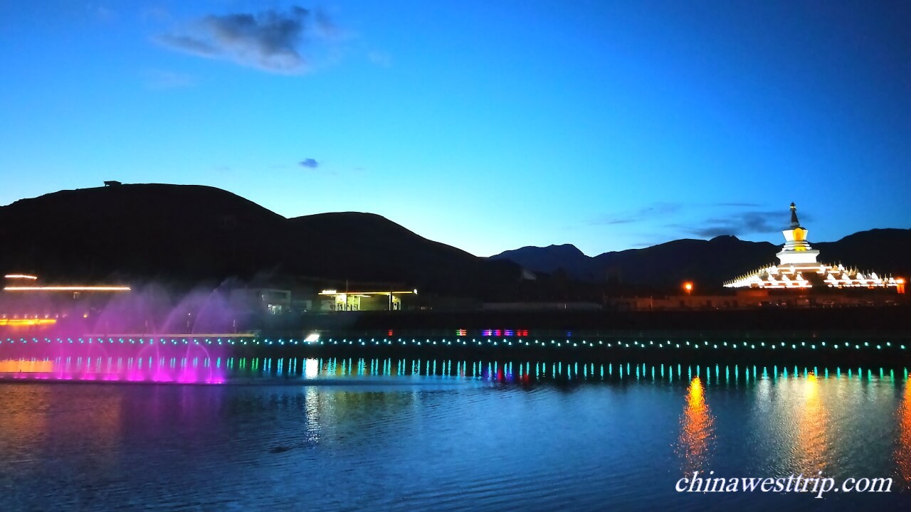
The major sightseeing spots in Yading Nature Reserve are the Pearl Lake, Luorong Pasture, Chonggu Lamasery, Chonggu Pasture, the Milk Lake, the Multi-colored Lake, Chenrezig Mountain, Jampayang Mountain and Chenadorje Mountain.
Chenrezig Mountain
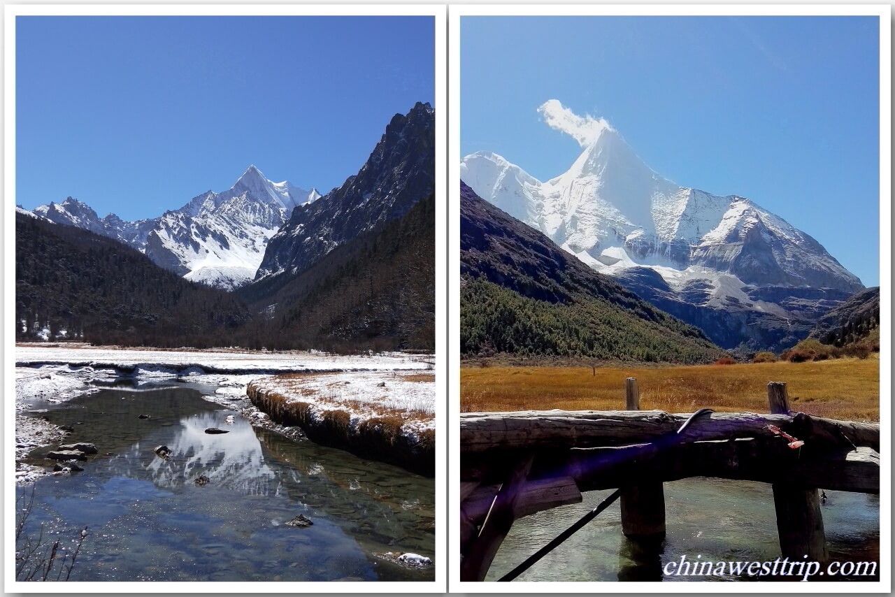
Chanrezig Mountain is called Xiannairi in Chinese. The peak is 6,032 meters(19,790 feet) above sea level. It is highest one among the three holy peaks in the whole nature reserve, the fifth highest in Sichuan Province. Chenrezig is considered as the incarnation of Avalokitesvara Bodhisattva.
The Pearl Lake
The Pearl Lake lies at the foot of Chenrezig Mountain. It is called Zhuomala-Cuo Lake in Tibetan language. Zhuomala means beautiful girl and Cuo means lake. A folk tale goes that the lake was a mirror belonged to a fairy maiden. The lake is 4,100 meters(13,541 feet) above sea level, covering an area of 7,500 square meters(1.85 acres). It is the best place for photographers to take photos of Chenrezig Mountain with its reflection on the water.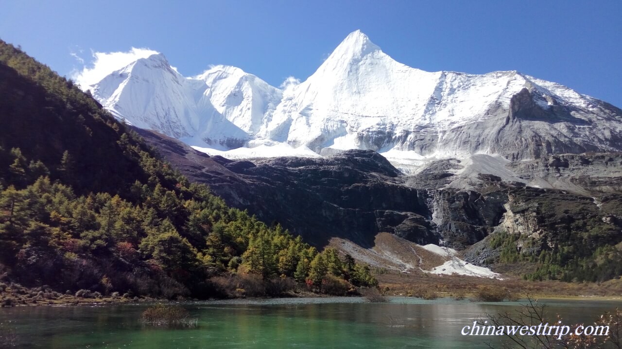
Chonggu Lamasery
Chonggu Lamasery is situated under the foot of Chenrezig Mountain. It is 3,880 meters(12,730 feet) above sea level. The monastery could be dated back to the Yuan Dynasty(1271-1368). It was rebuilt by Master Rangjiang Genqiu Jiacuo. He was one of the disciples of the Fifth Dalai Lama. In 1928, Joseph Rock spent three nights in the lamasery. Chonggu Lamasery serves as a fork of the paths leading to the three holy mountains.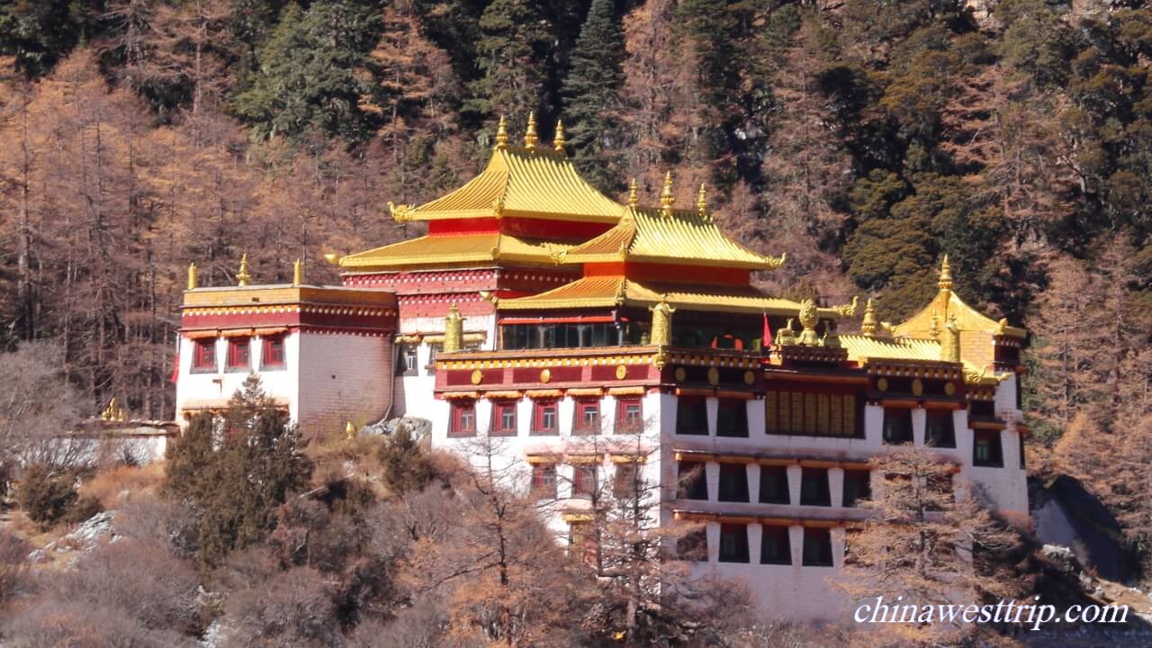
Chonggu Pasture
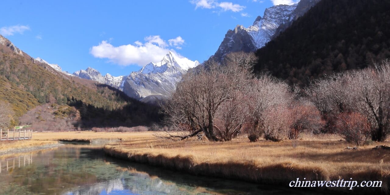
Chonggu Pasture is named after the lamasery. It is 3,800 meters(12,467 feet) above sea level, is the best place for visitors and photographers to view Chenadorje Mountain.
Jampayang Mountain
Jampayang Mountain is called Yangmaiyong in Chinese. The summit is 5,958 meters(19,547 feet) above sea level. It is considered as the incarnation of Manjusri Bodhisattva. In 1928, when the world famous explorer Joseph Rock stayed in Yading, he praised that Jampayang was the most beautiful mountain among those he had ever seen.
Chenadorje Mountain
Chenadorje Mountain is called Xianuoduoji in Chinese. The peak is 5,958 meters(19,547 feet) above sea level. Chenadorje is considered as the incarnation of Vajrapani Bodhisattva. It is a pyramid-like mountain. Joseph Rock likened the mountain as the emanation of Zeus, due to the magnificence and beauty of the mountain.
Luorong Pasture
The Pasture is surrounded by the three holy mountains. It is the best place for visitors and photographer to view Jampayang Mountain. The pasture is 4,150 meters(13,615 feet) above sea level. A trail leading to the Milk Lake and Multi-colored Lake starts from the pasture. The landscape is amazing, gorgeous and fascinating. That is just the real Shangri-La on the earth.
The Milk Lake
The Milk Lake is called Erongcuo in Tibetan language. It is 4,500 meters(14,764 feet) above sea level and 5,000 square meters(1.2 acres) in area. The trail between Luorong Pasture and the Milk Lake is about 5 km(3.1 miles). The lake appears green and blue. It looks like an attractive sapphire embedded on the ground.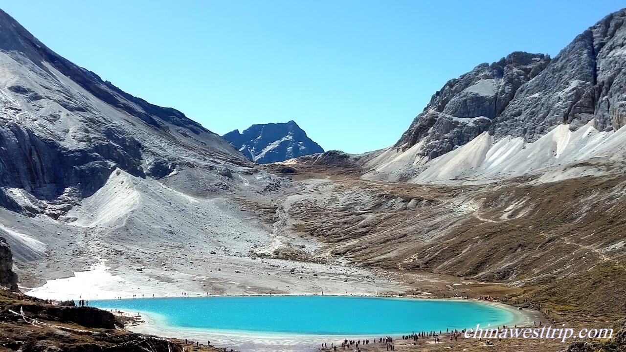
The Multi-colored Lake
The Multi-colored Lake lies between Chenrezig Mountain and Jampayang Mountain. It is 300 meters(984 feet) away from the Milk Lake, is 4,600(15,092 feet) above sea level, covering an area of 7,000 square meters(1.7 acres). The lake is called Danzencuo in Tibetan language, which means auspicious.
Yading Village
Yading Village is situated in the nature reserve. It is 34 km from the entrance gate of scenic area and 6.5 km(4 miles) to Chonggu Lamasery. It is a typical Tibetan-styled village, offering visitors accommodation. But compared with the town near the entrance gate, the accommodation the village provides is relatively poor.
The landscape along the road between Kangding and Daocheng is picturesque and appealing to photographers.
Xinduqiao Town
Xinduqiao Town is located in the west of Kangding, 77 km(47.8 miles) away from the city proper of Kangding, is known as the paradise for photographers, but compared with Daocheng Yading, it is exaggerated. The altitude of the town is about 3,300 meters(10,827 feet) above sea level.
The Eighteen Bends of Heavenly Road
The Road connects Chengdu with Lhasa is one section of the No.318 National Road. It is well-known as the most beautiful road in the world or the heavenly road. The road winds uphill from the county seat of Yajiang to Jianziwan Mountain Pass. The site of bends is 26 km(16 miles) away from the county seat of Yajiang. It is also a wonderful place for photographers to view Minya Konka, the highest mountain in Sichuan Province, which is 7,556 meters(24,790 feet) above sea level. A telephoto lens is required.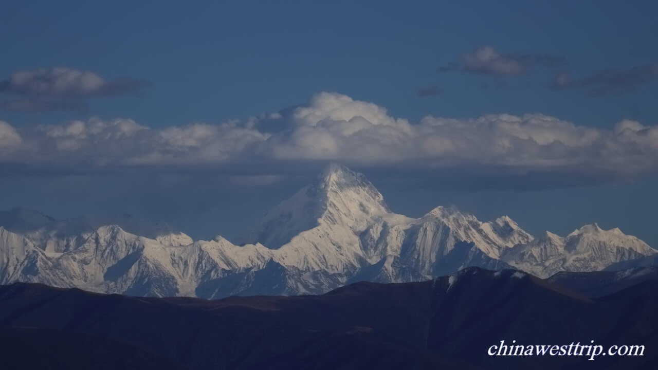
Kazila Mountain Pass
Kazila Mountain Pass is situated on the border between Yajiang County and Litang County, 75 km(46.6 miles) away from the county seat of Yajiang and 58 km(36 miles) away from Litang. It is 4,718 meters(15,479 feet) above sea level.
Litang County
Litang is known as the highest town in the world. It is the birthplace of the Seventh Dalai Lama. The town is 4,014 meters(13,169 feet) above sea level. It lies on a vast pasture and is surrounded by snow-capped mountains
Choekhorling Monastery
Choekhorling Monastery is called Changqing Chunkeer Lamasery or Litang Lamasery by Chinese people, is topped as the No.1 Lamasery in Kangba Tibetan area. It was built in 1580 by the Third Dalai Lama. It is situated at Litang County, around 1 km away from the town. Changqing refers to Maitreya Buddha, and Chunkeer means Darma. The monastery covers an area of 33 hectares(82 acres). There are over 800 lamas practicing their Buddhism in the monastery.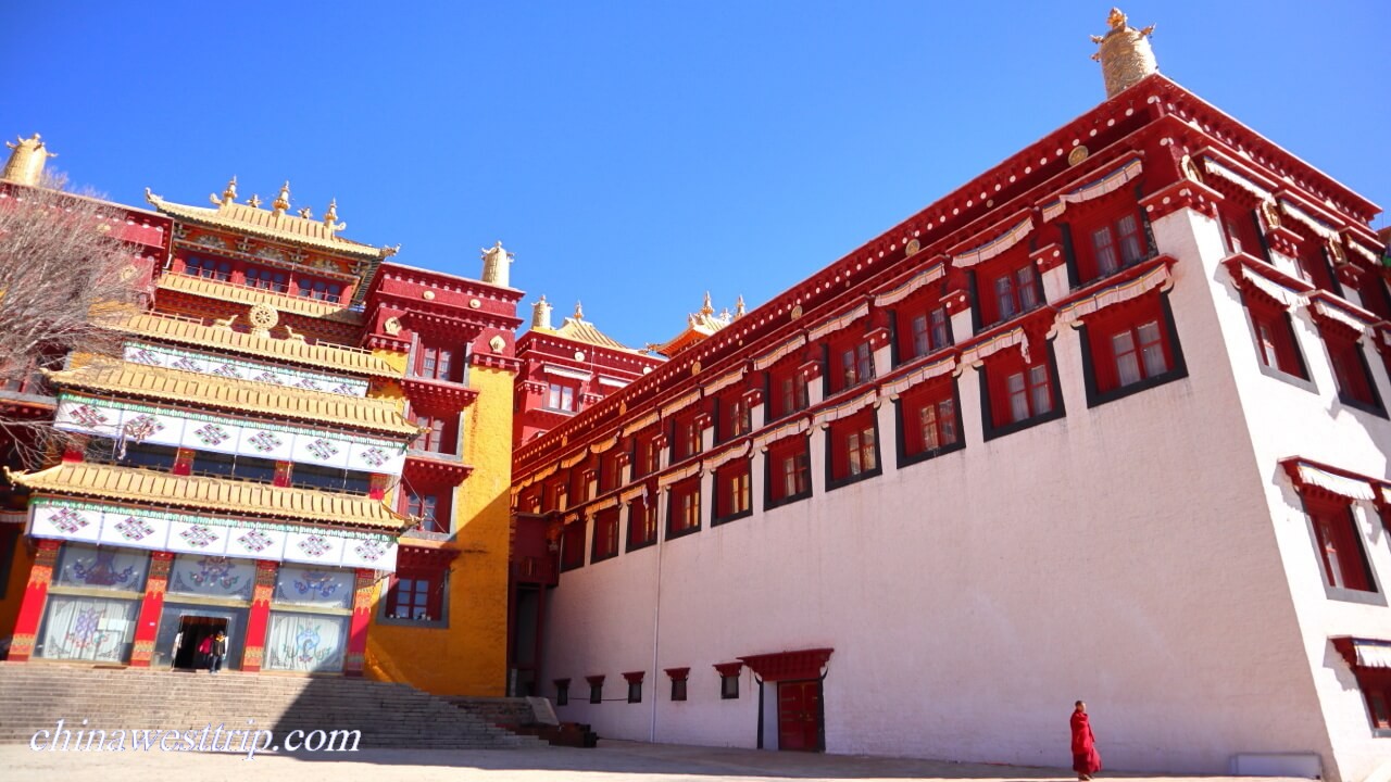
The Rabbit Mountain Pass
The Rabbit Mountain Pass is situated on the way to Daocheng Yading from Litiang. It is 4,686 meters(15,374 feet) above sea level. The silhouette of the mountain looks like a rabbit. That is the reason why people call it the Rabbit Mountain.
Haizi Mountain
Haizi is a Tibetan word which means lake in English. It is 94 km(58.4 miles) away from Litang County. The mountain pass is about 4,500 meters(14,764 feet) above sea level. There are totally 1,145 pools in the area. The pools were formed due to the movement of glacier.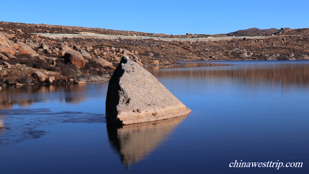
The Red-grass Wetland
The grasses grow in a small pool, and turn red in the mid of October. It lies between Litang and Daocheng, 142 km(88 miles) from Litang and 11 km(6.8 miles) from Daocheng.
Zunsheng Pagoda
Zunsheng Pagoda stands by Daocheng River. It is the largest pagoda in the whole Garze Prefecture, is the holy place of Tibetan people. The pagoda is 37 meters(121 feet) in height, surrounded by 119 small pagodas.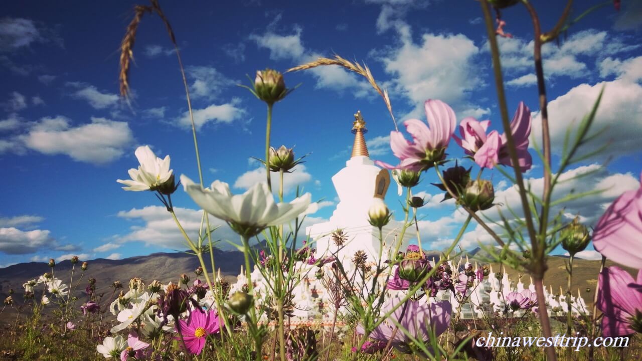
How to Get to Daocheng Yading
Daocheng is located in the southwest part of Sichuan Province, 681 km(423 miles) from Chengdu, 422 km(262 miles) from Kangding. Yading is situated in the south of Daocheng County, 75 km(47 miles) from the county seat. Visitors usually take a car or bus to visit Yading along the road connecting Chengdu with Yading. They can also go to visit many scenic areas along the way, like Siguniang Mountain, Jiaju Tibetan Village, Huiyuan Lamasery, Tagong Pasture, Mugecuo Lake, Hailuogou Glacier, and so on. Cities and towns suggested for travelers to spend the nights are Kangding, Yajiang, Daocheng, and Danba, due to the relatively lower elevation. There is an airport in Daocheng County. It is named Daocheng Yading Airport, the highest in the world in terms of its altitude. The airport is 50 km(31miles) away from the county seat of Daocheng, is 4,411 meters(14,472 feet) above sea level. It is highly suggested to travel to Daocheng Yading by car, because most of people may suffer from altitude sickness if they directly ascend to the height over 3,000 meters(9,842 feet) above sea level. It takes time for the body to acclimate the high altitude. Read more about the Altitude Sickness.
Travel Tips:
How to Visit Yading
Yading Nature Reserve is quite huge. Visitors usually spend two days for their tour in the scenic area. The tour to the Pearl Lake and Chenrezig Mountain is called the Short Route, and the tour to the Milk Lake and the Multi-colored Lake is called the Long Route. Sightseeing buses shuttle visitors back and forth between the entrance and Chonggu Lamasery. Some visitors go for the Short Route on the first day, some take the Long Route. The Short Route takes about five hours. The sightseeing spots include Chonggu Lamasery, Chonggu Pasture, the Pearl Lake and Chenrezig Mountain. The paths are well-paved. The Long Route takes about 8 hours. The sightseeing spots are Chonggu Lamasery, Chonggu Pasture, Luorong Pasture, Jampayang Mountain, Chenadorje Mountain, the Milk Lake and the Multi-colored Lake. Buggies shuttle between Chonggu Lamasery and Luorong Pasture. Visitors start to hike to both the Milk Lake and the Multi-colored Lake from Luorong Pasture. It takes at least three hours to get to the lakes, and most of people give up at the half way due to the lower oxygen intake.
How to Avoid Altitude Sickness
The altitude of Yading Scenic Area ranges from 2,980 meters(9,777 feet) to 4,600 meters(15,902 feet) above sea level. The highest sightseeing spot visitors can reach is 4,600(15,092 feet) above sea level. It is quite high, visitor should try to avoid the AMS. Please read more about AMS.
Weather
The temperature in Yading Nature Reserve ranges from minus 9℃(15.8°F) to 9℃(48.2°F) in spring, 4℃(39.2°F) to 17℃(62.6°F) in summer, 8℃(46.4°F) to 19℃(66.2°F) in autumn and minus 6℃(21.2°F) to 12℃(53.6°F) in winter. The best time to visit Yading Nature Reserve is between September and October. Visitors should try to avoid going to Yading in the rainy season. The rainy season in Sichuan lasts from July to August.
Because the altitude is high, visitors should prepare warm coat and try to decrease the risk of catching a cold.
Lunch
Visitors need to prepare packed lunches for the tours to both the Short Route and the Long Route.
Photography Tips
A tripod, a filter, telephoto lenses and wide angle lenses are needed.
1. The Pearl Lake is the most ideal place to view the reflection of Chenrezig Mountain on the water. Photographers would better to get to the lake before 11:00 A.M.. In the summer, it is possible for photographers to shoot a golden summit with its reflection inverted on the water, if they can get to the lake before 6:00 A.M. In the autumn, photographers should arrive at the lake before 9:00 A.M., so that they could get good photos of the red forest shining under the snow-capped mountains.
2. Luorong Pasture is the best place for photographers to take appealing photos of Jampayang Mountain. They should try to get to the pasture at 6:00 A.M. in the summer and 7:10 A.M. in the autumn.
3. Chonggu Pasture offers photographers a wonderful angle to shoot Chenadorje Mountain. The most ideal time lasts from the golden hour to the sunset.
Recommended Tour:
Twelve-day West Sichuan Pure Land and Tibetan Culture Exploring Tour
Related Articles:
Siguniang Mountain
Hailuogou Glacier
Mugecuo Lake
Jiaju Village
Huiyuan Lamasery
Altitude Sickness
Author: Tina Luo
Update:
